 Coop Security
Field pack · KPR · 2026-10-23
Kambah Pool Nature Reserve
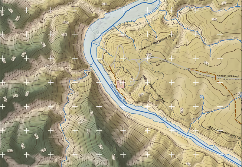
Sheet 04, topography: the map face. LiDAR 2020 © Australian Capital Territory and Aerometrex Limited, CC BY 4.0, modified · © OpenStreetMap contributors, ODbL, openstreetmap.org/copyright
- These maps are field aids. They are not a land survey, an engineering design, a biodiversity assessment, or legal or regulatory advice.
- The cartographic styling and the compass are this project’s own work, inspired by Alphonse Mucha. They are not Aboriginal art.
The sheets
Open any sheet
Each sheet opens as a PDF in a new tab. Its margin carries the credits for what it draws.
-
 Preview not available yet Sheet 01Site map: geology and mineral occurrences (PDF, opens in a new tab)
-
 Preview not available yet Sheet 02Site map: aerial imagery (PDF, opens in a new tab)
-
 Preview not available yet Sheet 03Site map: LiDAR canopy height (PDF, opens in a new tab)
-
 Preview not available yet Sheet 04Site map: topography, 5 m contours over LiDAR terrain (PDF, opens in a new tab)
-
 Preview not available yet Sheet 05Groundcover field datasheet (PDF, opens in a new tab)
-
 Preview not available yet Sheet 06Quadrat coordinates sheet (PDF, opens in a new tab)
-
 Preview not available yet Sheet 07Point-intercept sheets (PDF, opens in a new tab)
-
 Preview not available yet Sheet 08Field procedure sheet (PDF, opens in a new tab)
-
 Preview not available yet Sheet 11Plot plan: aerial imagery with the quadrat frames (PDF, opens in a new tab)
-
 Preview not available yet Sheet 12Plot plan: lithology with 0.25 m contours (PDF, opens in a new tab)
-
 Preview not available yet Sheet 13Plot plan: LiDAR canopy cover classes and tree-top heights (PDF, opens in a new tab)
-
 Preview not available yet Sheet 14Plot plan: 0.25 m ground model, slope and contours (PDF, opens in a new tab)
The pack’s README, with the sampling design and the exact rebuild command: README.md.
Download
The whole pack
One zip: every sheet as PDF, the GPX waypoints for a Garmin watch, the CSV and GeoPackage files, the README and ATTRIBUTION.md, about 17 MB.
The zip needs a verified request. Academic and non-commercial use is free with an education email; other uses are priced on the pricing list.
Request the zipYour request is verified. The link works for this browser tab; it was taken out of the address bar so it is not shared by accident.
Download the pack (ZIP)Cite and credit
Reference and figure credit
Shown as built: the pack’s whole credit line, and a reference to complete with the date you viewed it. With JavaScript on, both come from the pack service for the sheet you choose, with the time you viewed it.
The reference cites the pack in your reference list. The credit line goes in the caption of any map image you reproduce: the data licences require it wherever the image appears, so the reference alone is not enough.